 Overview of procedure (figure from paper)
Data descriptor published for the cloud removal procedure and data using Eurac’s MODIS snow maps. The paper is available here, and to be cited as:
Matiu, M., Jacob, A. and Notarnicola, C.: Daily MODIS Snow Cover Maps for the European Alps from 2002 onwards at 250 m Horizontal Resolution Along with a Nearly Cloud-Free Version, Data, 5(1), 1, doi:10.3390/data5010001, 2020.
See also the associated dataset and code.
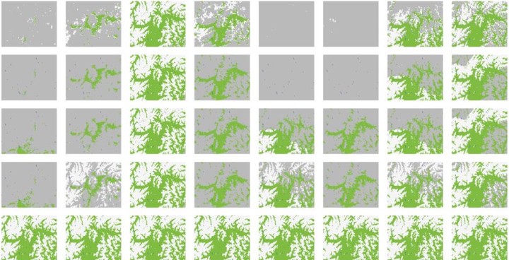
Abstract
Snow cover dynamics impact a whole range of systems in mountain regions, from society to economy to ecology; and they also affect downstream regions. Monitoring and analyzing snow cover dynamics has been facilitated with remote sensing products. Here, we present two high-resolution daily snow cover data sets for the entire European Alps covering the years 2002 to 2019, and with automatic updates. The first is based on moderate resolution imaging spectroradiometer (MODIS) and its implementation is specifically tailored to the complex terrain, exploiting the highest possible resolution available of 250 m. The second is a nearly cloud-free product derived from the first using temporal and spatial filters, which reduce average cloud cover from 41.9% to less than 0.1%. Validation has been performed using an extensive network of 312 ground stations, and for the cloud filtering also with cross-validation. Average overall accuracies were 93% for the initial and 91.5% for the cloud-filtered product using the ground stations; and 95.3% for the cross-validation of the cloud-filter. The data can be accessed online and via the R and python programming languages. Possible applications of the data include but are not limited to hydrology, cryosphere and climate.